Estimated read time: 2-3 minutes
This archived news story is available only for your personal, non-commercial use. Information in the story may be outdated or superseded by additional information. Reading or replaying the story in its archived form does not constitute a republication of the story.
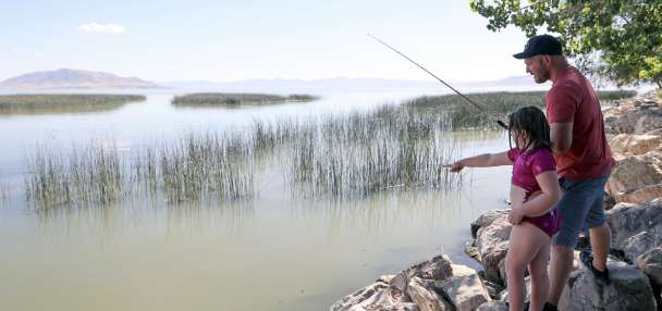
SALT LAKE CITY — A heat advisory will remain in effect across the Wasatch Front and northwest Utah through Friday morning as high temperatures could reach triple-digits Wednesday and Thursday with "limited overnight cooling" — but there is relief in sight.
In addition to the heat advisory, the National Weather Service also issued an excessive heat warning for the Glen Canyon Recreation Area/Lake Powell, where temperatures could reach 105 degrees, with overnight lows in the low- to mid-70s Wednesday and Thursday.
Utah's extreme heat is tied to an abnormal pattern that developed in the Southwest and Pacific Ocean, KSL meteorologist Matt Johnson explained. A low-pressure system off the Baja California, Mexico, coast is sandwiched between a high-pressure ridge farther west in the ocean and another that's just south of the Four Corners region.
The pattern pumps in warmer and drier desert air from the south into Utah. It amplifies daytime temperatures and — in this case — it will keep overnight temperatures in the 70s. Cloud cover is forecast for southern and central Utah on Thursday, which could offer slightly lower temperatures in those parts of the state.
Temperatures will drop somewhat on Friday, as temperatures along the Wasatch Front are forecast to top out in the mid-90s. Pop-up showers are possible in parts of central, southern and eastern Utah, Johnson said. He adds that more "seasonable" temperatures should return this weekend as the high-pressure system moves east.
All of this is before a "substantial cooling trend" forecast to arrive by the start of next week, offering relief from extreme heat. Models indicate a low-pressure system moves into Utah from the Pacific Northwest, bringing in cooler air from Alaska that could dip temperatures to slightly below normal for mid-June.
"It's moderated cold Alaskan air. By the time it reaches us, it will moderate to 70s," he said. "It won't be a short cooldown. I think it could hang out with us for three to six days."
Long-range outlooks list northwest Utah and the Wasatch Front as having greater odds for below-normal temperatures next week, before the odds shift back to above-normal after that.
In the meantime, the National Weather Service offered a few tips for Utahns to handle the heat over the next few days:
- Drink plenty of fluids and stay in an air-conditioned room as much as possible.
- Limit time outdoors and wear lightweight and loose-fitting clothing. If possible, move strenuous activities to early morning or evening.
- Check on relatives and neighbors.
- Don't leave children or pets unattended in vehicles.
Salt Lake County Health Department said cool zones are set up for anyone without immediate access to air conditioning, to offer cool-downs throughout the day.
Full, seven-day forecasts for areas across Utah can be found online, at the KSL Weather Center.