Estimated read time: 3-4 minutes
This archived news story is available only for your personal, non-commercial use. Information in the story may be outdated or superseded by additional information. Reading or replaying the story in its archived form does not constitute a republication of the story.
SALT LAKE CITY — Extreme heat will linger across the Wasatch Front for a few more days, while flash flooding potential lingers across southern Utah to start this week, as different weather patterns continue to play out across the state.
The National Weather Service on Monday issued excessive heat warnings and heat advisories throughout the Wasatch Front, northern Utah, the West Desert and parts of central Utah that will remain in effect through Tuesday night.
The hot temperatures are the result of a high-pressure ridge that is set up over New Mexico at the moment, says KSL meteorologist Matt Johnson. Temperatures are forecast to reach the upper 90s and lower 100s over the next two days, while overnight lows may "briefly" touch the mid-70s, according to the National Weather Service.
The agency's alerts advise residents to take precautions by staying hydrated and avoiding the sun as much as possible. It recommends people stay in air-conditioned rooms and wear lightweight and loose clothing as much as possible when outside during the heat of the day.
Children and pets should also not be left unattended in a vehicle at any time.
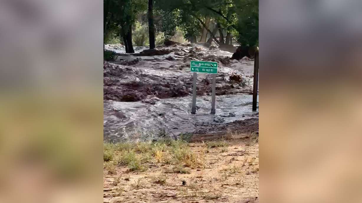
But the high-pressure system won't prevent some scattered showers from continuing to impact southern Utah over the next few days, which could produce more flash flooding in the region after moisture tied to the remnants of Tropical Storm Alberto primarily impacted central, eastern and southern Utah.
The weather service advises flash flooding is "probable" in recreation areas like Capitol Reef National Park, Glen Canyon National Recreation Area and Grand Staircase-Escalante National Monument on Monday, and is "possible" at a few other recreation areas across southwest and south-central Utah. It's possible on Tuesday across many of the same areas.
There is an elevated risk for flash flood across portions of southern Utah including Capitol Reef, the Grand Staircase-Escalante National Monument, and Glen Canyon Rec Areas today (Monday). The flash flood risk will remain elevated through mid-week as well. #utwxpic.twitter.com/WDh8F5eNYk
— NWS Salt Lake City (@NWSSaltLakeCity) June 24, 2024
Johnson explains the potential is coming from scattered showers that will likely move into southern Utah as they bounce around the high-pressure system. The flooding risk could increase on Wednesday as more widespread scattered showers are forecast, but that will also put an end to the excessive heat.
That's because a storm pattern from the Pacific is expected to produce showers and thunderstorms across most of the state on Wednesday. High temperatures across the Wasatch Front are forecast to drop into the upper 80s and lower 90s by the end of the workweek, as well.
Full seven-day forecasts for areas across Utah can be found online at the KSL Weather Center.
This week's projected rain builds on what Utah received over the past few days.
Communities in central and eastern Utah, like Blanding, received 1.37 inches of rain, while Price and Bluff also ended up with over an inch of rain. Some other nearby communities — like Moab and Price — wound up with just under an inch, although higher and lower totals were possible throughout the region because of the scattered nature of the storms.
This was both good and bad news for the impacted regions. On one hand, it helped the driest part of the state, as the U.S. Drought Monitor lists most of eastern Utah as either in moderate drought or "abnormally dry" — accounting for nearly all the drought in the state.
But Johnson said some of the totals were collected in short bursts, which led to flash flooding that displaced some residents in the impacted regions.
The system also provided some decent rain totals in the Wasatch Front, which wasn't initially projected to receive much rain. Salt Lake City received a third-inch of rain and Magna received over a half-inch on Friday.


