Estimated read time: 4-5 minutes
This archived news story is available only for your personal, non-commercial use. Information in the story may be outdated or superseded by additional information. Reading or replaying the story in its archived form does not constitute a republication of the story.
SALT LAKE CITY — If April showers bring May flowers, Salt Lake City is really going to blossom next month.
Following the most recent rainstorm Monday and Tuesday, Utah’s capital city has already surpassed the precipitation average for meteorological spring (March-April-May) at its halfway point.
The average for those three months is 5.73 inches of precipitation and the National Weather Service reported the city reached 5.86 inches for spring 2019 by 3:30 p.m. Monday.
As of Tuesday afternoon, 6.37 inches of precipitation has been recorded at the Salt Lake City International Airport, which is where the weather service records its data.
“It’s been a consistent weather pattern without the presence of any high pressure and, as a result, we just keep getting one system after another that’s put all the snow in the mountains and in the valleys, and it’s just what we need,” said Brian McInerney, a hydrologist for the National Weather Service, describing the city’s spring to this point.
He added this spring — just past the halfway point — is already one of the wetter springs on record.
“Overall, it’s just been consistent and that’s been the key, but it really started in February and then went through March, and now April has been quite wet also,” he continued.
Salt Lake City’s rain amount is vastly different from last year.
At 10.5 inches of precipitation, the National Weather Service reported that Salt Lake City had its ninth-driest water year on record dating back to 1874. The city also experienced its third-highest annual average temperature on record in 2018.
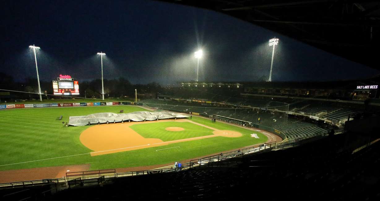
Here’s one way to visualize the change from 2018 to 2019 to this point: The Salt Lake Bees baseball team had two games postponed and another game — as a part of a doubleheader — suspended because of rain during their first seven scheduled home games over the past week. The team had just one postponed game in 70 scheduled home contests throughout last season.

End of drought in sight?
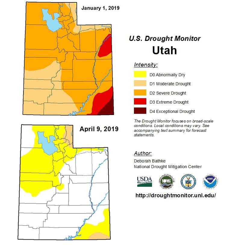
More rain is forecasted for the weekend and that’s fantastic news as Utah nears falling off the U.S. Drought Monitor. As of April 9 (prior to the latest rain storms), the monitor listed the majority of northern Utah as “abnormally dry” — with a pocket of moderate drought around Rich County.
Southern San Juan County — with a mix of abnormally dry and moderate drought — was the only other portion of the state listed on the monitor.
McIrney said the current projections have the entire state out of a drought within the next month, which is impressive considering the position Utah was in heading into 2019.
The combination of heat and dryness recorded in Salt Lake City last year was found all over the state and resulted in a massive drought. Entering 2019, nearly 100 percent of the state was considered to be in at least a moderate drought and close to three-fourths of it was in a severe drought.

The state was in an even worse position before that, McIrney added.
“If you go back to last fall when we started the water year, the biggest drought designation in the entire country (was) in southeast Utah. It was considered the driest, most drought-ridden area,” he said.
In addition to the spring rain, Utah’s snowpack totals have helped erase the deficits. All snowpack locations in the state reported more than 130 percent of the average, as of Tuesday afternoon.
“This has been a great change from what we’ve had last year and really 2012 through 2016, where it was really dry and warm,” McInerney said. “You haven’t really seen that this year.”
Related:
McInerney also expects most of Utah’s reservoirs — aside from Bear Lake and Lake Powell — will return to full or near 100 percent capacity by the end of the spring runoff when the snow melts.
Despite pockets of sunny weather also in the forecast, there are no true signs the second half of spring will dry up.
“When I talk to the meteorologists at the weather service, they indicate there’s no long-range pattern shift that they can see that would bring us into very hot and dry conditions,” McInerney said. “We don’t see any of that. For now, we’ll wait and see and most likely keep on with this wet weather.”


