Estimated read time: 2-3 minutes
This archived news story is available only for your personal, non-commercial use. Information in the story may be outdated or superseded by additional information. Reading or replaying the story in its archived form does not constitute a republication of the story.
SALT LAKE CITY — I hadn’t ever been to Deseret Peak before, but after reading a few good reviews and seeing a couple amazing pictures, I put the range on my hiking radar and left it there for far too long. Fortunately, my perseverance was rewarded in the end, though perhaps not in the way I most wanted.
Deseret Peak is perhaps one of the greatest peaks to climb in the Salt Lake area because of its close proximity, accessibility and breathtaking views. The trailhead is a little over an hour from downtown Salt Lake, which doesn’t differ much from the time it takes many hikers to access the more popular Big and Little Cottonwood Canyons.
The 4-mile dirt road is also very well-maintained. The peak’s height, prominence and isolation provide unobstructed 360-degree views of incredible scenery.
We started our four-mile hike to the Loop Campground at the road’s end. Even on a dark, overcast night, the scenery along the road was quite amazing. Our little headlamps revealing several large rock formations split in half by a small rushing creek (the “Narrows”).
We arrived at the campground and found one of the eight sites that was open for a $14 fee. It is unlikely that this campground would fill up, but there are at least three other nice campgrounds in the area that are available.
Related Stories:
The Deseret Peak loop is a well-established path with more signage than you see on many Wasatch Front trails. It begins climbing through thick deciduous forests until it reaches patches of some of the tallest aspen trees I’ve ever seen. You’d never expect such lush greenery when you see the expanses of desert that surround the range.
Over the course of the 8-mile loop, we saw a total of 30 deer, wandering around and searching for sustenance, most of them right along the trail.
The initial climb to the peak is a solid 3,500 foot gain over four miles, an ascent that might be a little difficult for some hikers, but still manageable with time and determination. After reaching the peak, we continued on the north leg of the loop, which follows the main ridge until it descends down a breathtaking hollow, the best view of the whole hike for us.
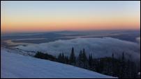
We began moving out of the clouds as we moved away from the peak, which afforded us nice views of the range and its forests, meadows, ridges, and rock formations. We were also able to see the aftermath of several fires that recently occurred in the area, including some of the burned-out areas from the Patch Springs fire this summer.
Despite the weather issues, the hike itself was still incredible. The limited scenery we were able to see was beautiful, and I can only imagine the grandeur of the area on a clear day. The area has definitely found a permanent home on my radar.


